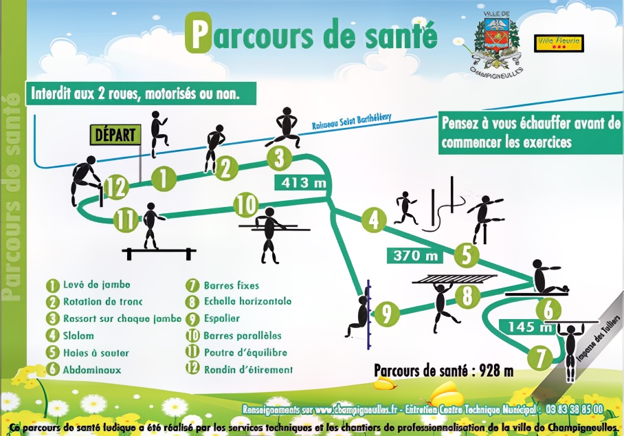
Health Trail of Château Park (Champigneulles)
Description
This trail, located in the heart of the Parc du Château in Champigneulles, features a well-maintained path with wooden stations created by young people in vocational training. There are two entrances for access, and the route is set within a wooded environment that includes a castle, pétanque courts, and a mountain biking circuit.
The Health Trail of Château Park (Champigneulles) trail is 928 m and has 12 stations. The positive elevation is 11 m, the terrain is mostly flat. It is located in Champigneulles, in the department of Meurthe-et-Moselle.
fitness_center Stations along the trail
directions_run Suggested workout
Here is a complete workout to do on site, matched to the equipment on this trail. Pick your level to adjust each exercise.
self_improvement Warm-up
Start with five to ten minutes of brisk walking. Loosen your shoulders, hips and ankles with small gentle movements to get your body ready for the effort.
 fitness_center
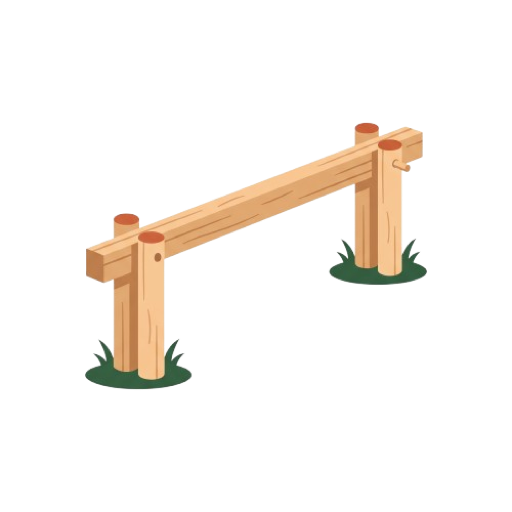
Balance beam
Montez à une extrémité de la poutre. Avancez pas à pas en regardant droit devant vous. Écartez légèrement les bras pour vous équilibrer. Traversez jusqu'au bout sans poser le pied au sol.
 fitness_center
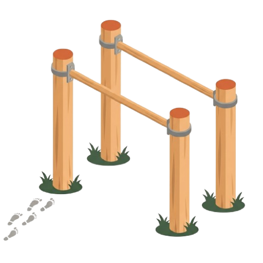
Parallel bars
Placez-vous en appui, bras tendus entre les deux barres. Fléchissez les bras pour descendre le buste. Remontez en poussant sur les mains.
 fitness_center
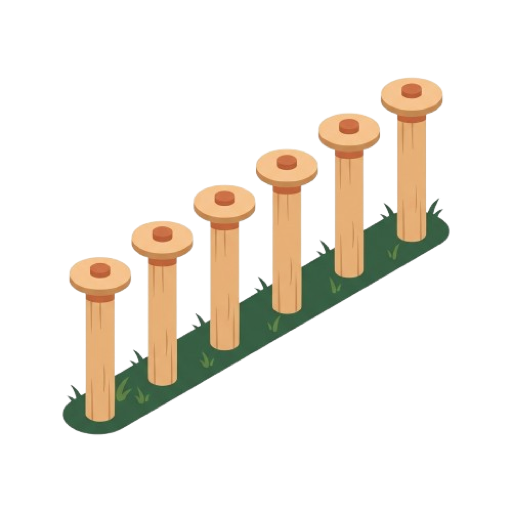
Slalom
Partez du premier poteau. Contournez chaque poteau en alternant les côtés. Gardez le buste bas dans les changements de direction.
 fitness_center
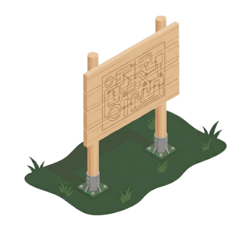
Start sign
Lisez le plan pour repérer l'ordre des ateliers. Notez les consignes propres à chaque exercice. Choisissez une boucle adaptée à votre niveau avant de partir.
spa Cool-down
Finish with a few minutes of slow walking. Gently stretch your legs, back and arms, holding each position for a few seconds without forcing.
rate_review User Reviews
Loading reviews...
Author
Mickaël LEBRET
verified_user
Verified on 10/11/2025
Technical information
Distance : 928 m
Elevation : 11 m
Equipment : 12
City : Champigneulles (54)
Directions to start